

Sri Lanka agriculture flooding damage has been laid bare by new FAO-backed maps that reveal the extensive impact of Cyclone Ditwah on key farming regions. The data-driven assessment highlights severe losses to paddy, vegetable, and field crops, raising concerns over livelihoods and food security.
Sri Lanka agriculture flooding damage mapped as Cyclone Ditwah hits key farm districts
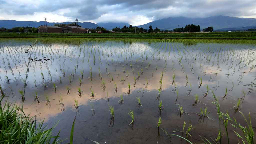
Fresh mapping released by the United Nations Food and Agriculture Organisation, in collaboration with Sri Lanka’s Department of Agriculture, has provided the clearest picture yet of the damage inflicted on the country’s agricultural sector by recent flooding. Triggered by Cyclone Ditwah, the floods have affected vast stretches of cultivated land, particularly in the Eastern Province, underscoring the vulnerability of farming communities to extreme weather events.
According to the maps, approximately 58,340 hectares of paddy land in the districts of Trincomalee and Batticaloa alone were impacted. These two districts, both critical contributors to national rice production, account for a substantial share of the overall losses recorded during the event. The spatial analysis also shows widespread damage to vegetables and other field crops, indicating that the disruption extends beyond staple rice cultivation to diversified farming systems.
The mapping initiative combines ground-level agricultural data from the Department of Agriculture with satellite-derived flood extent information. This integrated approach allows authorities and development partners to identify not only where flooding occurred, but also which crop types and growth stages were most affected. As a result, the assessment offers a more nuanced understanding of how extreme weather translates into economic and food production losses.
FAO officials warned that the implications of Sri Lanka agriculture flooding damage go far beyond immediate crop destruction. In a statement accompanying the release, the organisation noted that such impacts directly threaten rural livelihoods, household food security, and national food availability, particularly for smallholder farmers who often lack financial buffers or insurance coverage. For many farming families, the loss of a single season’s harvest can have cascading effects on income, nutrition, and debt levels.
The maps highlight that damage was not evenly distributed. Several major agricultural districts recorded concentrated losses, reflecting localised rainfall intensity, river overflows, and drainage constraints. In low-lying paddy-growing areas, prolonged inundation has likely resulted in total crop failure, while in slightly elevated zones, partial damage may still reduce yields significantly. Vegetable and field crops, which are generally more sensitive to excess water, also suffered extensive losses, compounding the overall impact on farm incomes.
From a policy perspective, the FAO-supported analysis provides an essential evidence base for response planning. By pinpointing affected areas with precision, national authorities can better prioritise relief measures, rehabilitation efforts, and resource allocation. This includes decisions on seed re-distribution, fertiliser support, restoration of irrigation infrastructure, and targeted cash or food assistance for the most vulnerable households.
The Department of Agriculture has indicated that the new data will feed directly into post-disaster assessments and recovery strategies. With climate-related shocks becoming more frequent, such tools are increasingly critical for moving beyond reactive responses toward more anticipatory and resilient agricultural planning. The use of satellite data, in particular, enables rapid assessments even when ground access is limited by floodwaters or damaged infrastructure.
FAO has reiterated its commitment to working closely with Sri Lankan authorities and local partners to support recovery and rehabilitation. This cooperation involves not only quantifying losses, but also identifying urgent needs and longer-term interventions to strengthen resilience. Measures under consideration include promoting flood-tolerant crop varieties, improving water management systems, and enhancing early warning and advisory services for farmers.
The broader context of Sri Lanka agriculture flooding damage also raises concerns about national food supply dynamics. Paddy losses in major producing districts can tighten rice availability in subsequent months, potentially putting upward pressure on prices. When combined with vegetable crop damage, the effects may be felt by consumers through reduced market supply and higher food costs, particularly in urban centres dependent on rural production.
For smallholder farmers, the challenge is especially acute. Many operate on narrow margins and rely heavily on seasonal harvests for both consumption and income. Flood-related losses can force households to reduce food intake, delay education or healthcare spending, or take on high-interest debt. FAO has stressed that timely and well-targeted assistance is essential to prevent these short-term shocks from turning into longer-term development setbacks.
The mapping exercise also serves as a reminder of the growing importance of climate-informed decision-making. As extreme rainfall events become more intense and less predictable, the agricultural sector must adapt through better risk assessment, diversified cropping systems, and stronger institutional support. Data-driven tools, such as the FAO and Department of Agriculture maps, are central to this transition.
Ultimately, the release of these maps marks a significant step toward transparency and preparedness. By clearly illustrating where and how floods have affected agriculture, the initiative equips policymakers, donors, and development agencies with the information needed to respond effectively. While the scale of the damage is sobering, the availability of detailed, actionable data offers a pathway toward more resilient recovery and future risk reduction for Sri Lanka’s farming communities.